This website uses cookies for analyzing traffic and improving user experience through Google Analytics. These cookies help us gather information about how you use our site. Your data is anonymized and is not used to identify users. Do you agree to the use of analytical cookies?
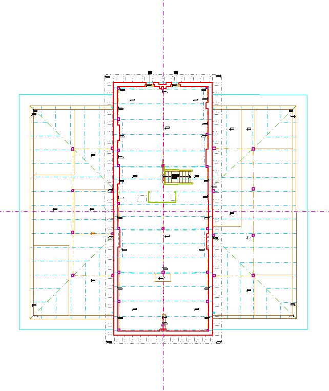
Architectural surveying enables the preparation of precise as-built documentation of existing buildings – both contemporary and historic.
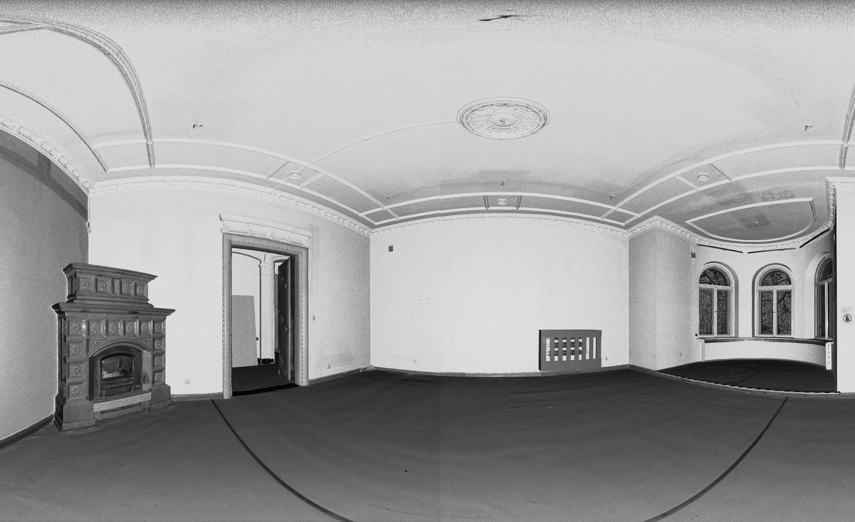
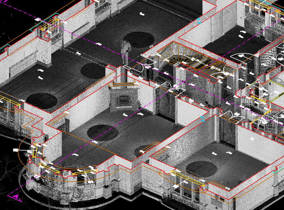
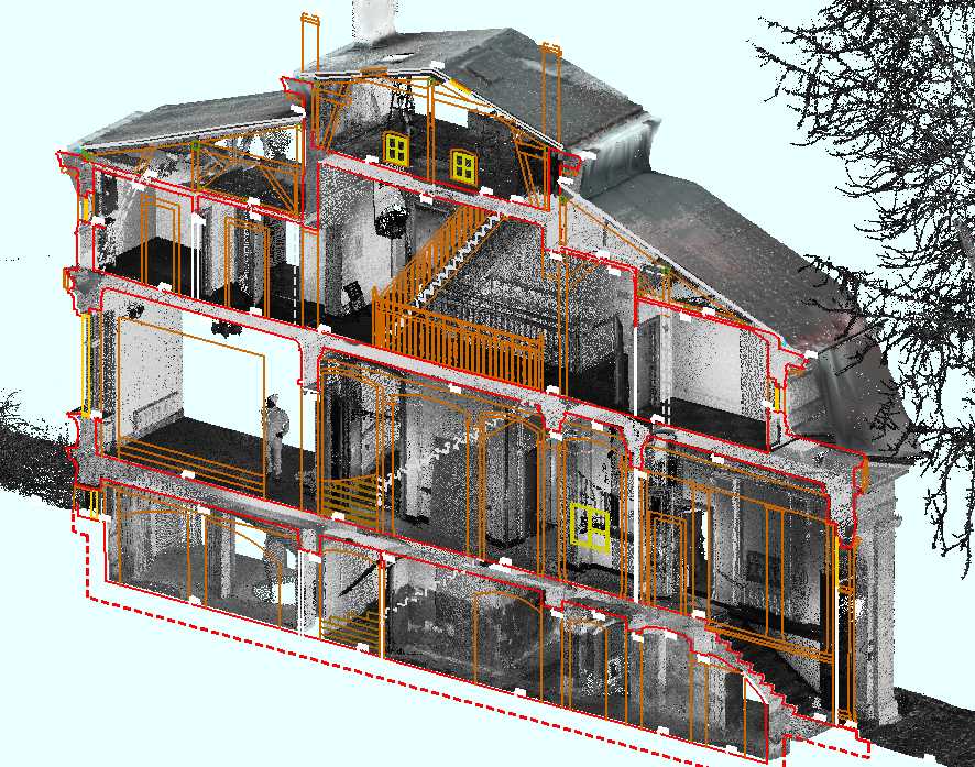
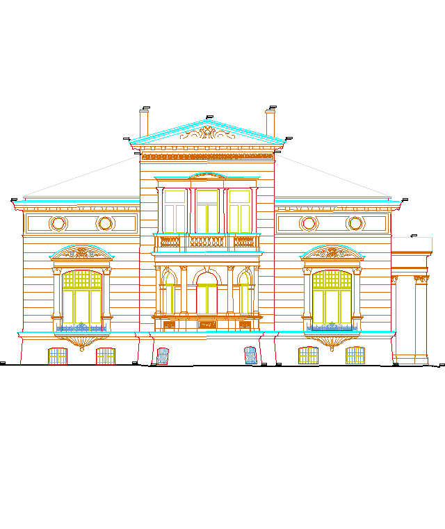
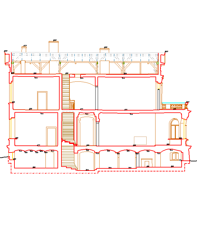
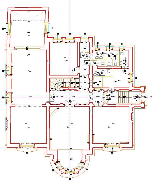
We provide our clients with point clouds, drawings,
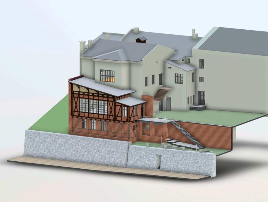
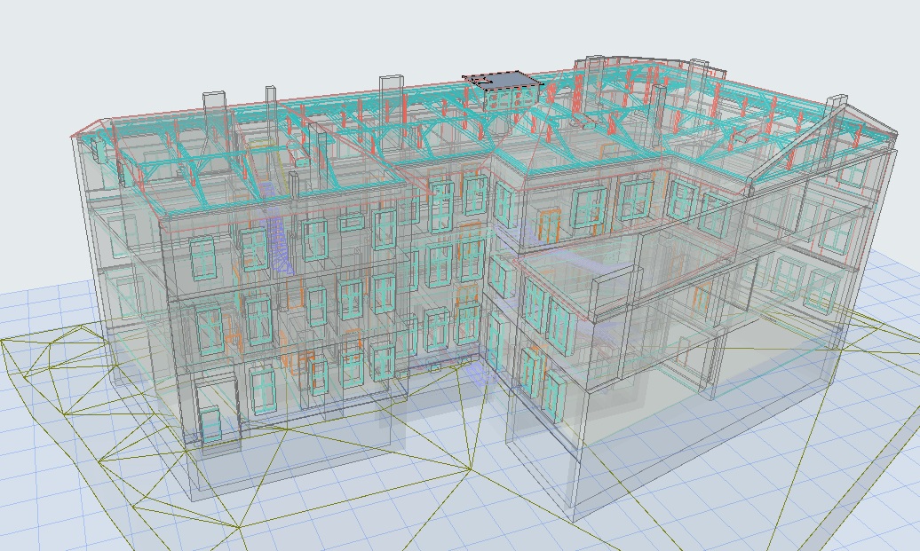
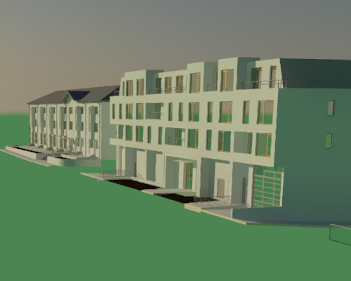
as well as 3D/BIM models.
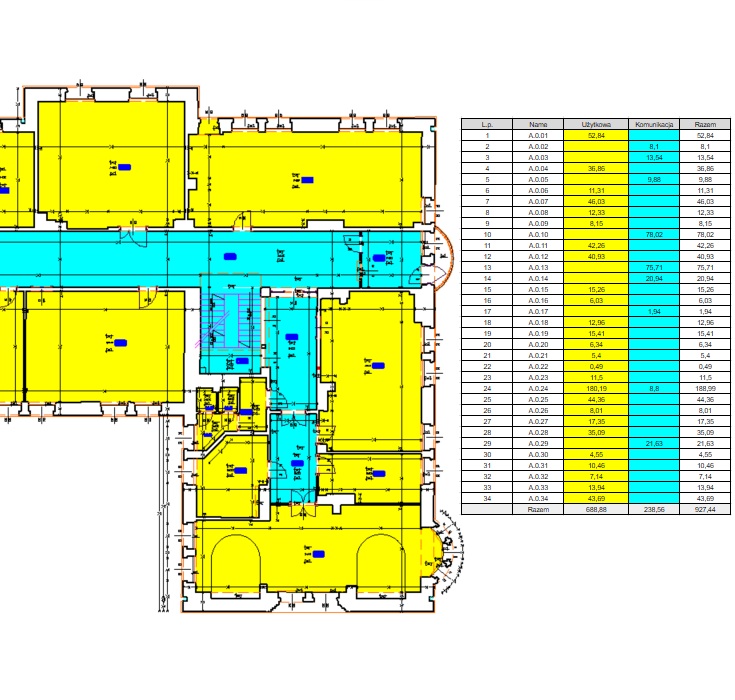
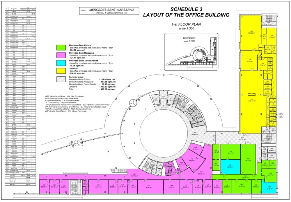
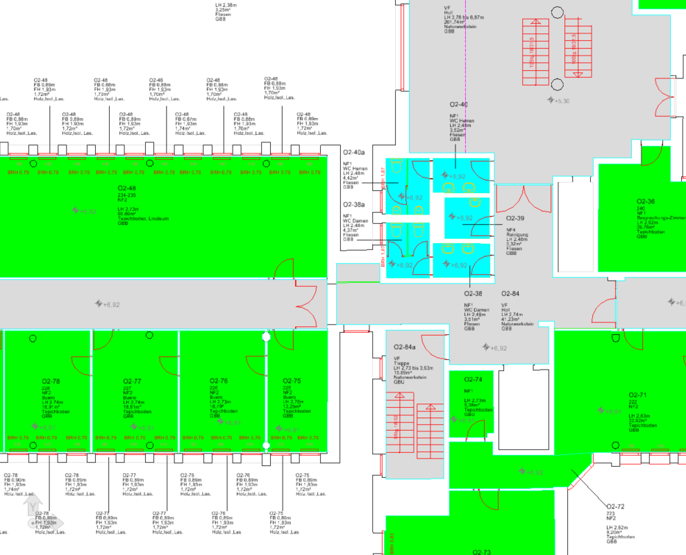
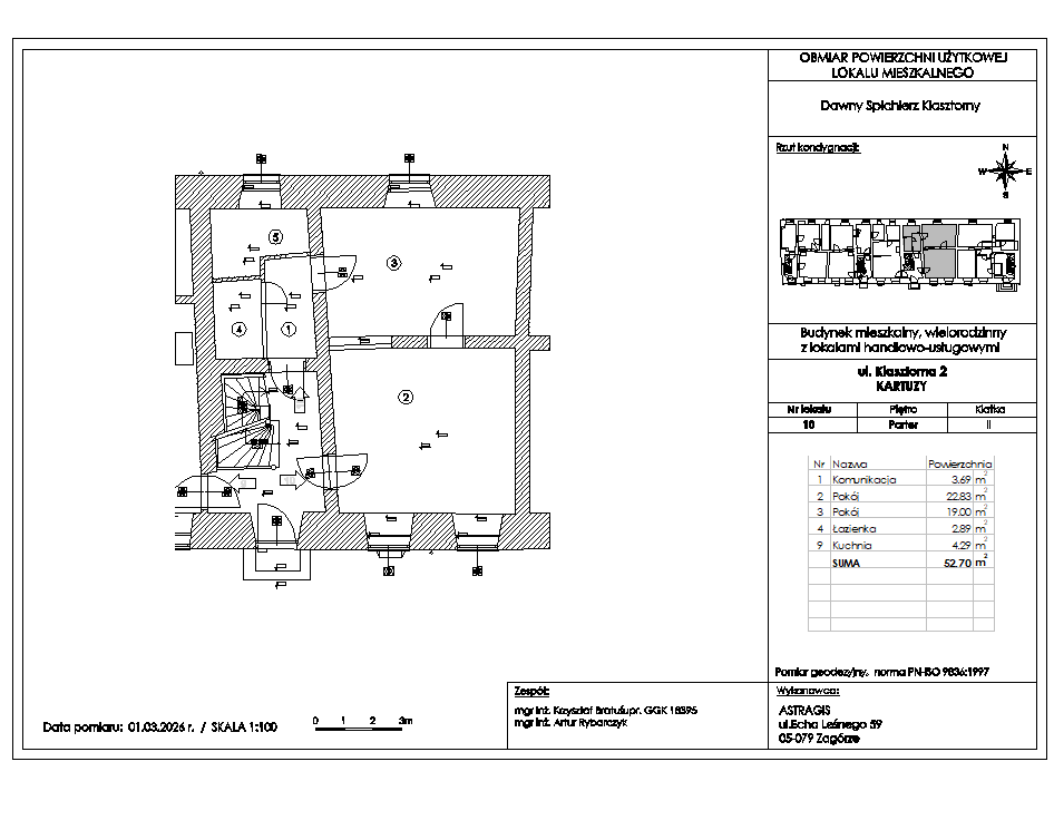
We also offer usable floor area schedules as well as wall flatness and deformation analyses.
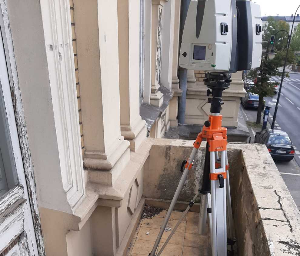
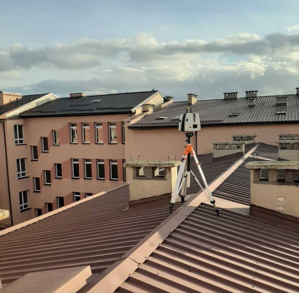
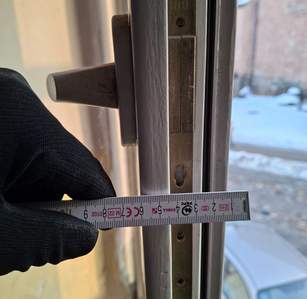
Measurements are carried out using modern geodetic technologies and 3D laser scanning, ensuring high accuracy and a complete representation of the building geometry.
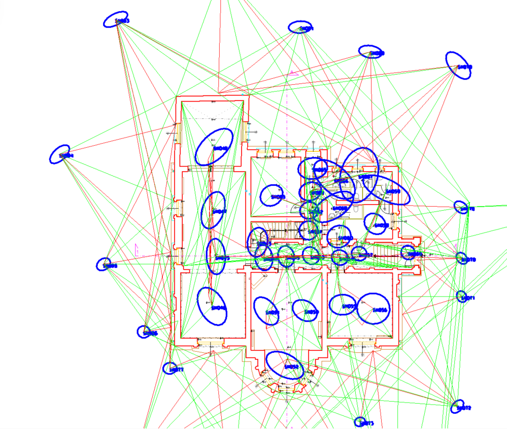
The acquired data undergo a registration process, during which station coordinates and all parameters required for further work with the point cloud are determined.
Our calculations are based on geodetic methods that guarantee reliable quality assessment and full control over the accuracy of the deliverables.
As the first team on site, we fully understand that the documentation we prepare forms the foundation for subsequent design stages. We therefore make every effort to ensure that the quality of our work remains at the highest level.
A point cloud allows you to work on a precise "3D copy" of an object. When creating 2D drawings or 3D models, reliable and verified measurement data together with the point cloud form the foundation.
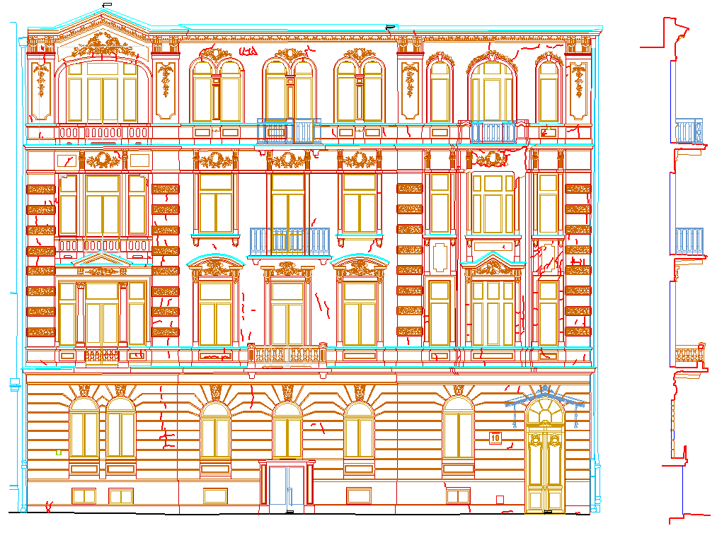
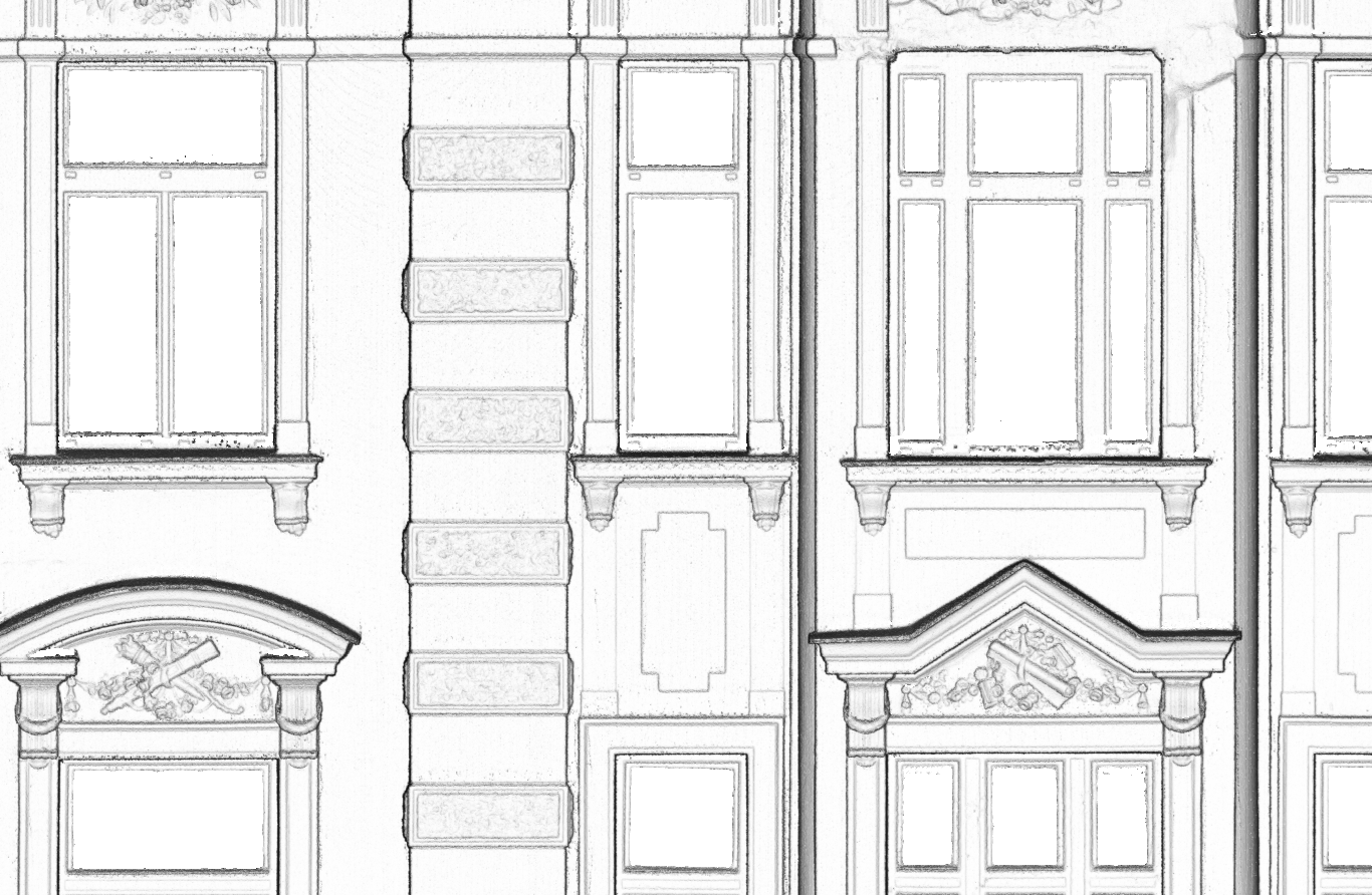
2D drawings, such as plans, sections and views, are still the most important type of documentation. However, the number of deliverables prepared as 3D models is also steadily increasing.
Measuring usable floor area based on laser scanning ensures the required level of accuracy. We prepare area schedules and unit data sheets in accordance with relevant standards and the expectations of our clients.
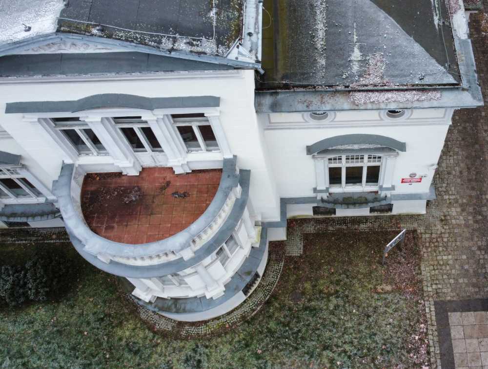
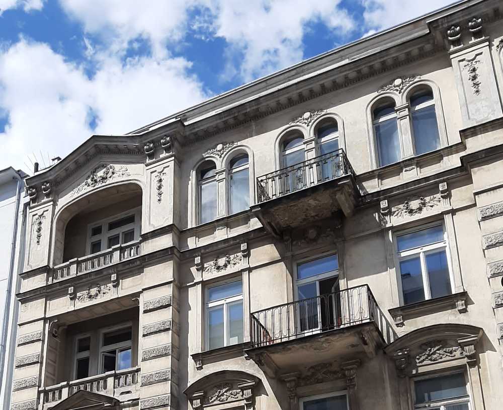
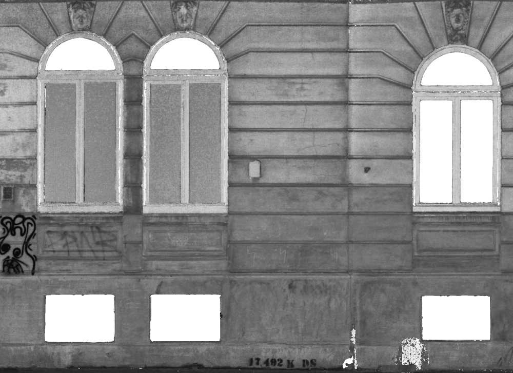
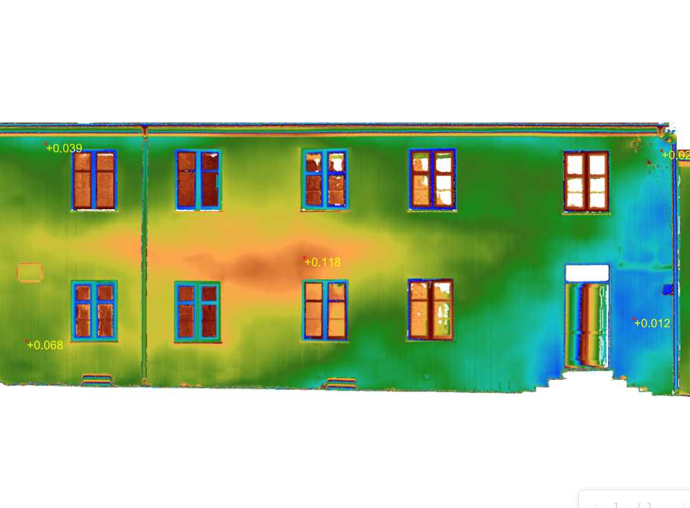
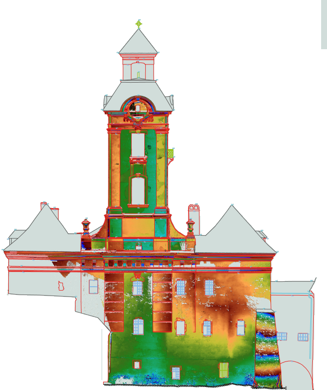
Facade surveying is a separate task that we perform using both laser scanning and photogrammetry. We prepare drawings and orthophotos based on scan data and photographs.
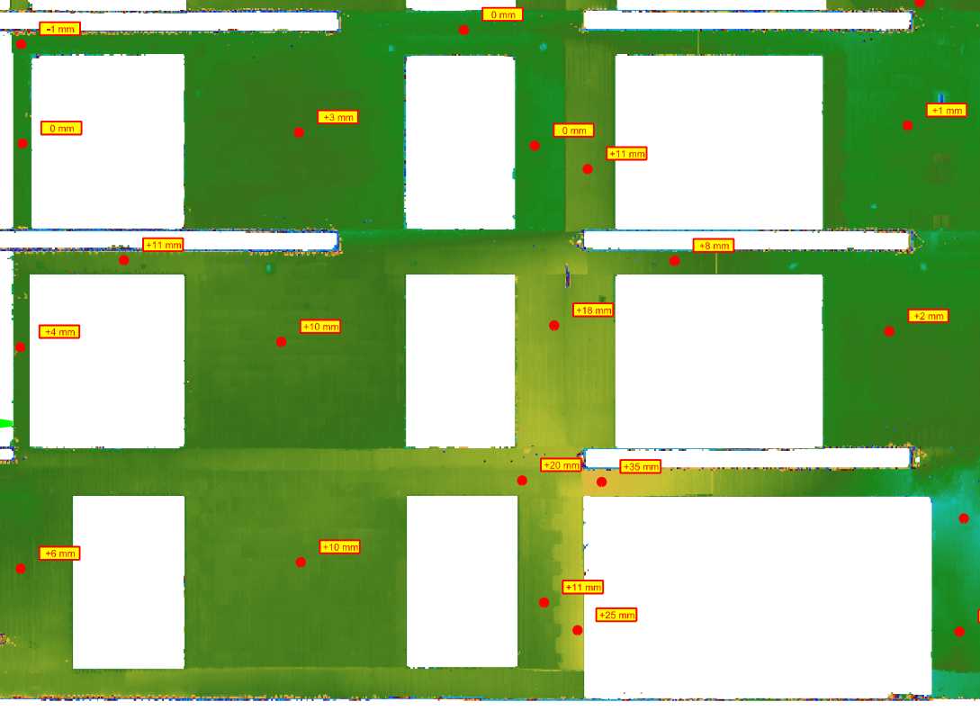
Deformation analysis allows the identification of areas where unfavorable phenomena may occur.
BIM modeling and 3D models are becoming an increasingly important part of our projects.