This website uses cookies for analyzing traffic and improving user experience through Google Analytics. These cookies help us gather information about how you use our site. Your data is anonymized and is not used to identify users. Do you agree to the use of analytical cookies?
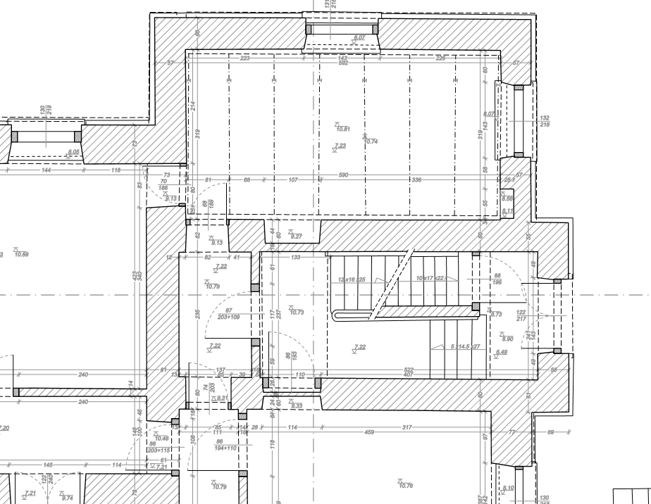
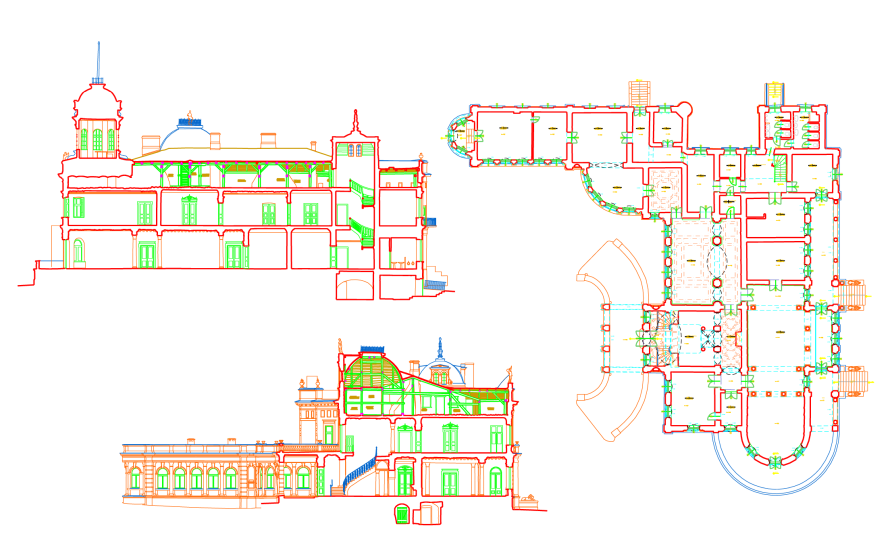
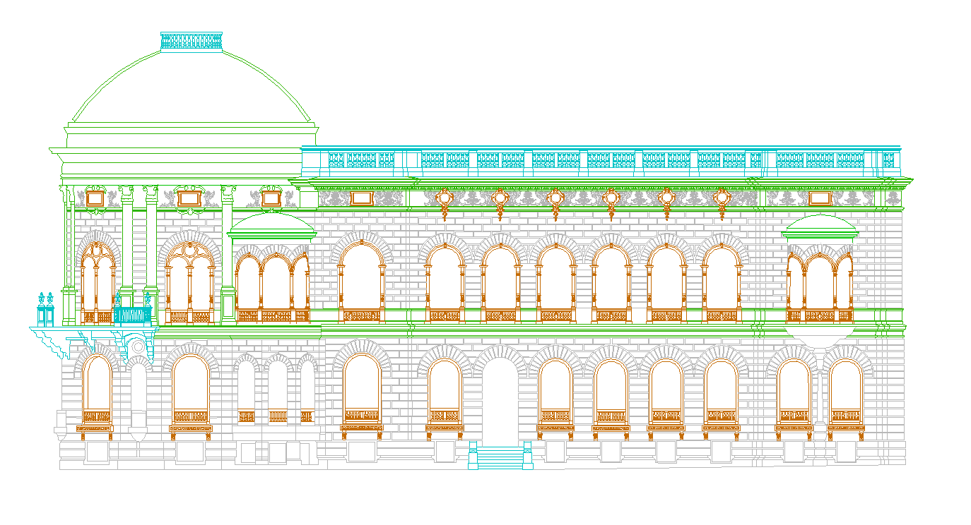
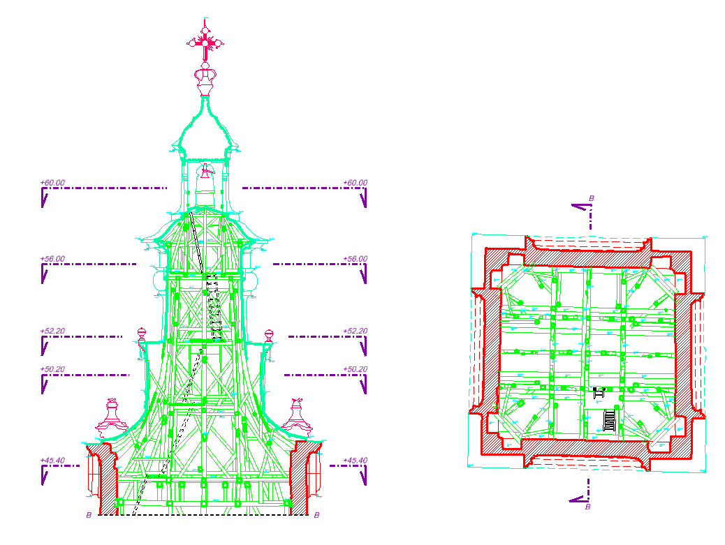
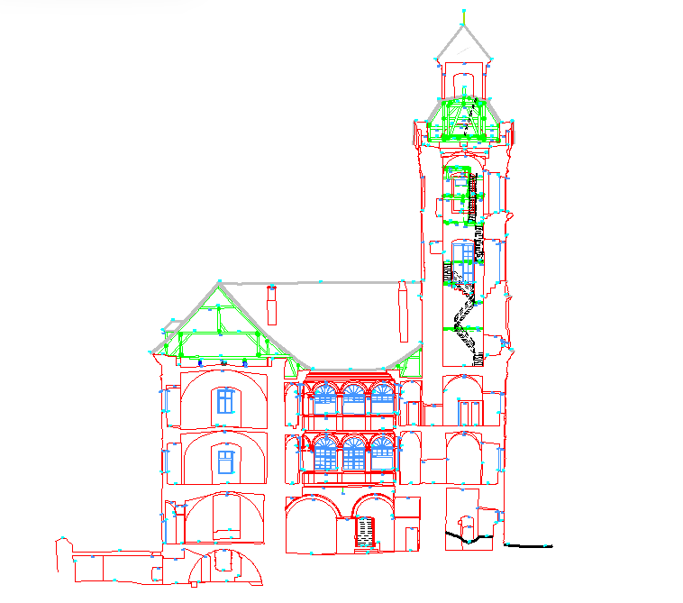
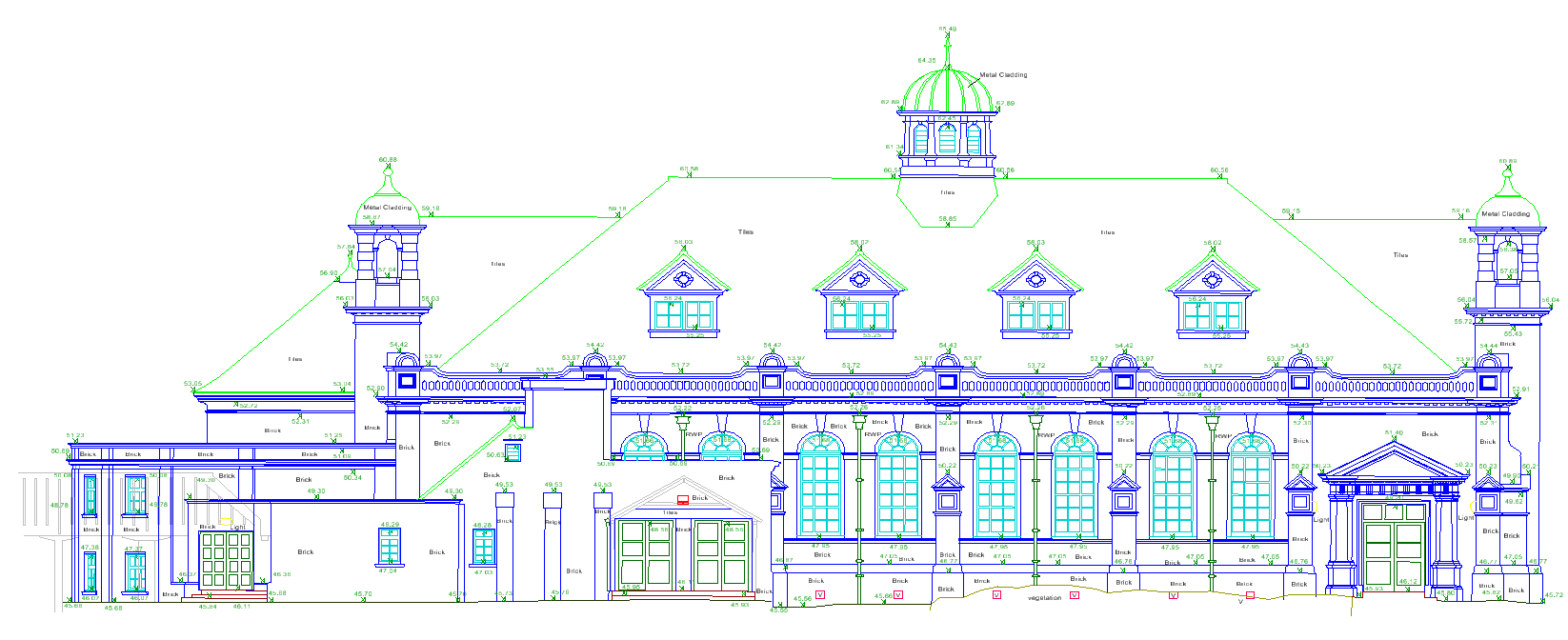
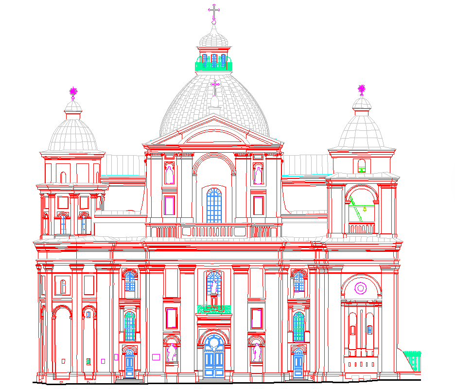
Floor plans, sections, and elevations are often the basis for starting work on existing buildings.
Old plans, if they exist, are usually insufficient because they were created at a time
when the commonly used measurement technologies did not allow achieving the accuracies required today.
Of course, the buildings themselves have been renovated and altered so much
that they sometimes no longer match the original documentation at all.
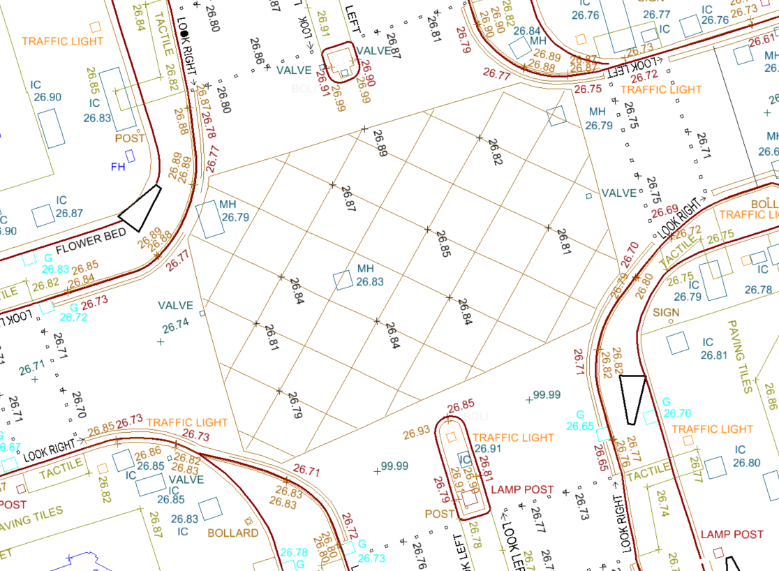
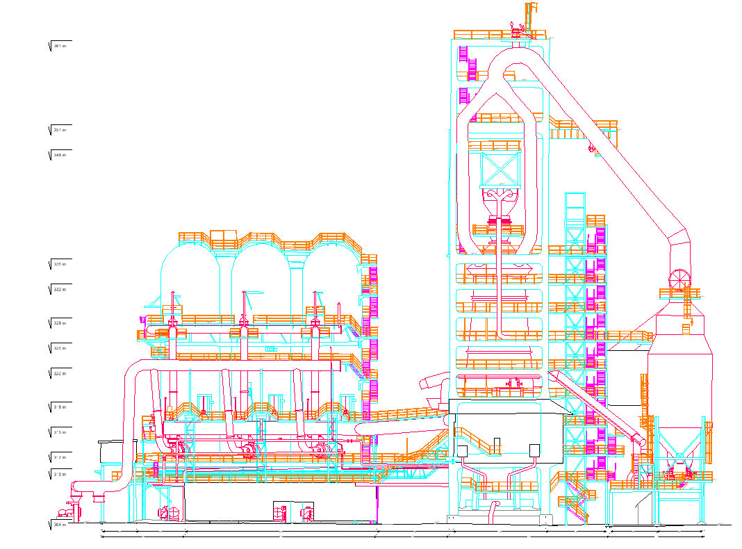
Laser scanning enables the processing and modeling of road infrastructure objects.
We create maps based on point clouds. It should be noted that every vertex and symbol is placed at the correct elevation (so-called 2.5D map).
We also work with point clouds provided by the client.